| Mount Whitney
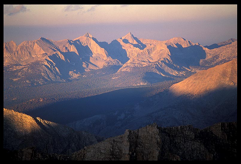
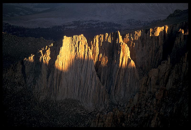
We got up REAL early that morning to climb Mt. Whitney and finalize our JMT trek. We hiked for a couple hours in total darkness, using our headlamps to make our way up the steep switchbacks to Trail Crest. Brrrrr, it was freezing cold! We were over 14,000' high and still climbing. Jim had misplaced his headlamp and had ingeniously taped a LED pinch-light to the bill of his cap. It worked fine. Talk about "light weight"! The sun was just coming over the Inyo Mountains across the Owens Valley, and flooding the highest peaks of the Great Western Divide with warm light. The shadowline moved quickly. It was an incredible feeling knowing we were just a few hundred yards from the end of the JMT, and the top of the highest spot in the lower 48. But... brrrrr!
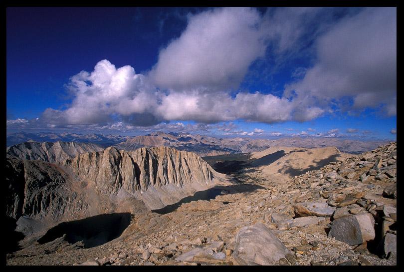
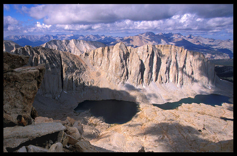
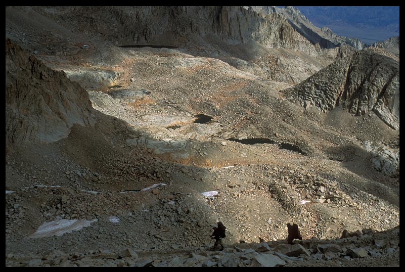
That's the Great Western Divide in the background, and the Bighorn Plateau in the middle. The JMT skirts that lake you can see on the plateau. We hiked that section two days prior, and it was cool to look down on whence we came. It's amazing country.
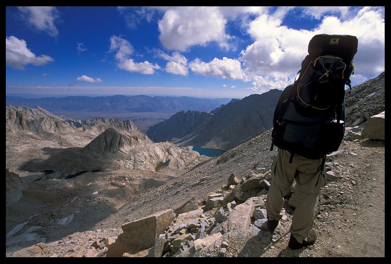
This is early in the morning, the sun had just popped up high enough to light the tip of the Sierra crest, but most of the landscape behind Whitney was still pretty dark. And it was COLD. No, it was FREEZING. I'm very thankful I didn't hafta go pee at this point. The JMT goes hundreds of miles without ever crossing a road, one of the few stretches of trail in the lower 48 that can make this claim. When I look out from the top of a high pass or summit and see the endless sea of distant peaks, peak after peak after peak, I realize I can't work a traditional 40 hours a week, 50 weeks out of the year. I MUST explore. I MUST. I'll be tramping through the wilderness somewhere again this weekend. And you better believe my dogs will be with me.
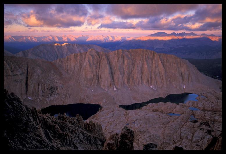
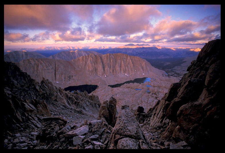
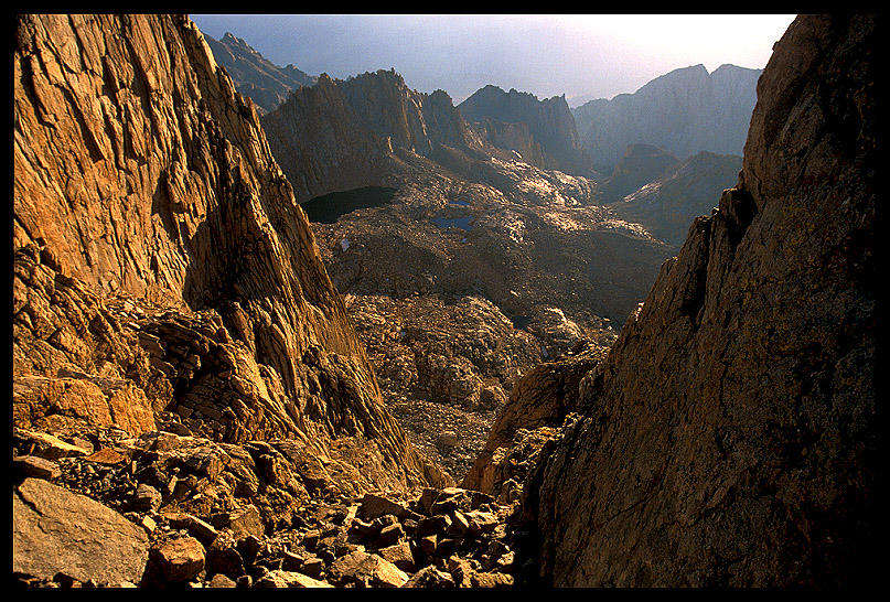
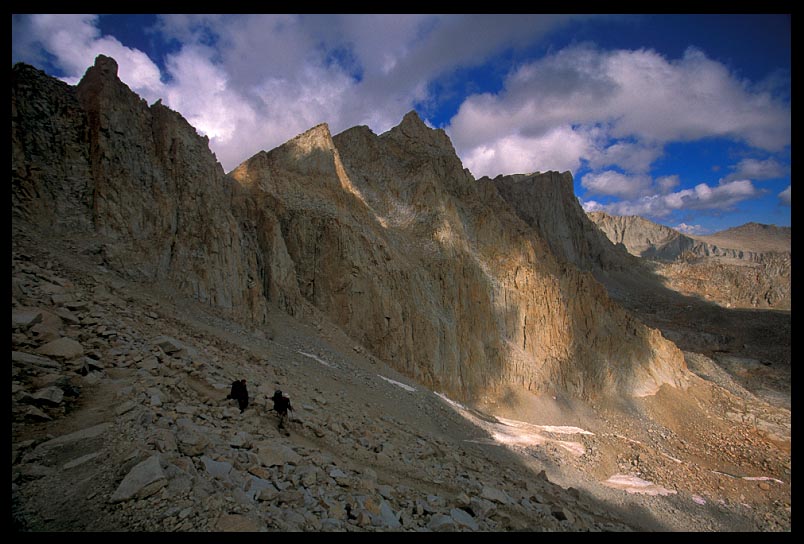
View Through Pinnacles, Mt. Whitney Trail. Photos were taken as we neared the summit of the highest spot in the contiguous U.S. The sun was just rising over the Inyo Mountains to the west, blasting the east face of Mt. Whitney with a warm glow. The light may have been warm, but the temperature sure wasn't. It was freezing cold, and the wind was howling. Clouds zipped-by just out of reach overhead. On one side the trail dropped thousands of feet, and on the other side the trail hugged the high ramparts of the eastern ridge. Every now and then a window between the pinnacles would open up, allowing a sliver of a vista back down the east side. It's a sheer vertical drop for thousands of feet. The wind funnels extra hard through these windows, which makes peering over the edge even more exciting. It's a neat world up there.
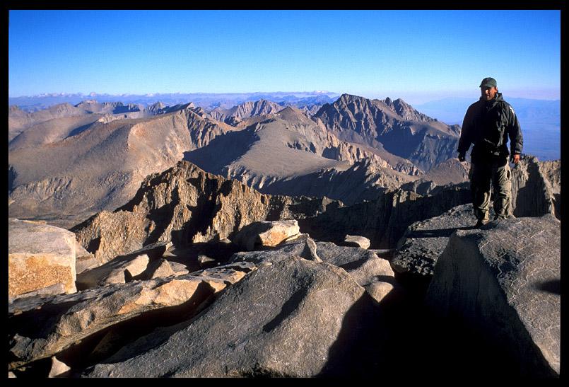
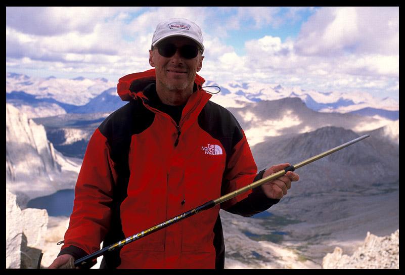
Here's a shot of me, taken by Jim S., in howling winds so cold that we just wanted to get the flip off the mountain asap. I don't know how Jim kept the camera so still in that cold, and in that wind. It was way too windy for a tripod. Behind me is a cliff so steep and high that if I slipped and fell, I could've written a detailed trip report before I hit bottom.
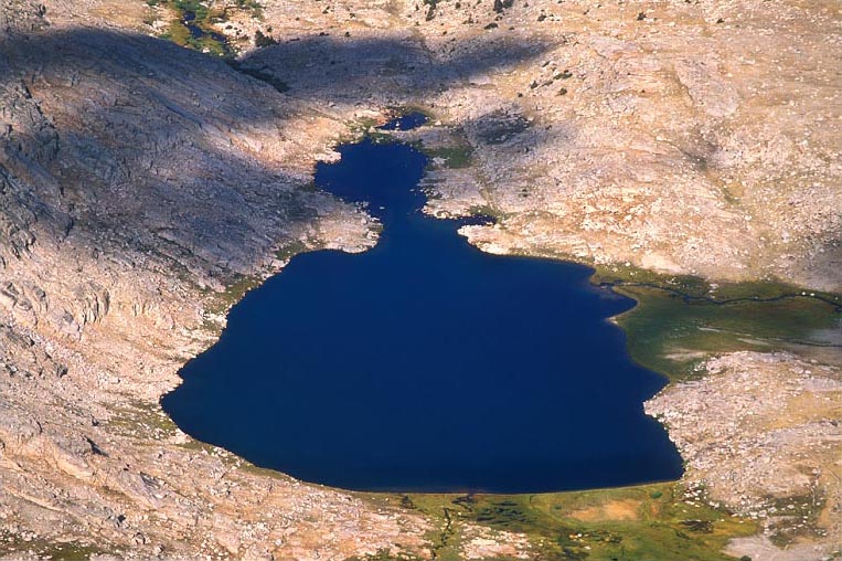
Guitar Lake as seen from the neck of Mt. Whitney. Please note the shape of the lake was instrumental in picking the name of this lake. Gee, Buck, ya think? When thunder resounds through this basin, the acoustics are amazing. We should know, there was an electrical storm when we were there. Realizing we were in treble, we got our amps out of there in a hurry. I know, you can't stanza my puns any more. Don't fret, I will refrain from any further puns.
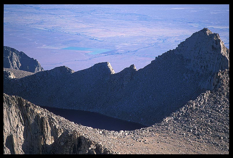
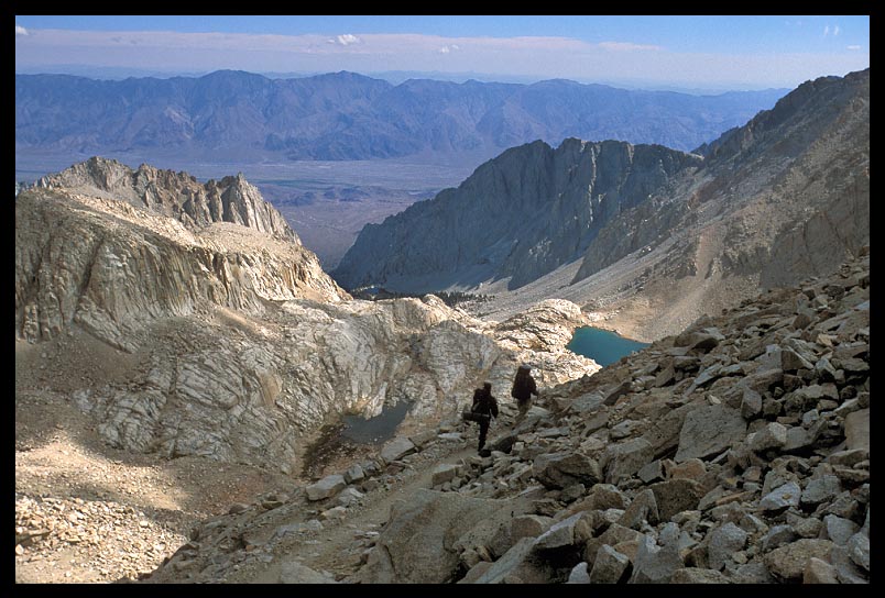
This is Tulainyo Lake, which I think is considered the highest big lake in the lower 48. At least that's the rumors I've heard, so I could be mistaken. This was taken from the summit of Mt. Whitney looking down on the bowl that holds Tulainyo Lake. I think the lake gets its name from a combination of Tulare County and Inyo County. That's the Owens Valley many thousands of feet below it. These mountains jut up from the east side at a fierce angle, which is why it makes for some of the best hangliding in the solar system.
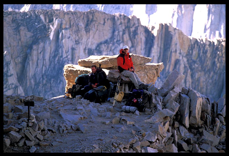
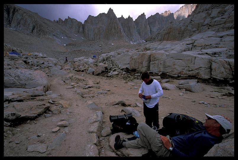
This is the junction of the JMT and the Mt. Whitney trail. Jim and Dave rest after having climbed Whitney and are now resting (and waiting for me and my steeeenkin' photo stops). This is where the infamous marmot crawled up Jim's arm. We were all smiles at this point, as we had completed the official JMT and it was pretty much a downhill slog for 11 miles back to Whitney Portal, where cheeseburgers and cheerleaders awaited us. I feel sorry for the maid who had to clean our hotel room the next day.
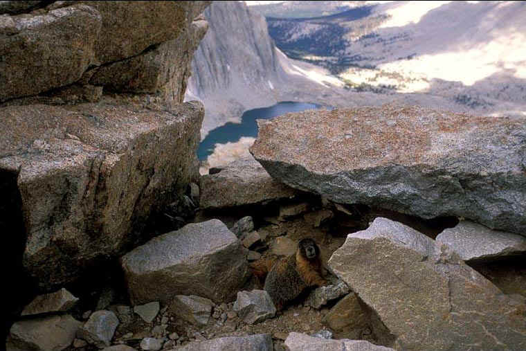
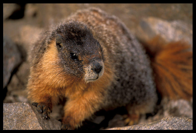
This marmot does very well for himself and his family. He resides at Trail Crest®, which is a registered trademark (TM) of Sequoia® National Park.gov. Trail Crest is at 13,777'. This is actually just a little ways down from Trail Crest, at the meeting of the eastside and westside trails up Mt. Whitney. It's where weary backpackers leave their food-laden packs and make the 5 mile round trip up the summit of Whitney. This marmot makes an absolute killing here. It has a very plush home under a beautiful boulder with a sweet view. It has miniature oxygen tanks flown in every few days, and his home is protected from mountain lions with a very sophisticated system that he asked me not to share with others on the internet. It HAD to of cost him at least 8 kilos of Planters® cashew nuts to buy it though. It's a nice setup to say the least. The lighting wasn't great to try and capture him on this perch, but here's the best I could do. The darn marmot wanted 5 packets of oatmeal and a 3/4 box of Cracker Jacks® to pose, which I didn't have, so this is a candid shot. If you haven't noticed, the marmot is in the lower left hand corner of the photo, blended in with the rocks. Those aren't real rocks though, they're fake and hinged and controlled with a remote control to be arranged for optimal pillaging of backpack food, of which a number of packs are nearby and unattended when I took this photo.
We were talking with a couple of other people who did the JMT as well
while we were at this spot. Jim S. was talking with a guy and his wife about their trip,
casually, when out of nowhere, without changing his voice inflections or anything, this
guy says, "there's a marmot on your arm". If we didn't actually hear the words,
we would've never known by his voice. Not that a marmot on Jim's arm is alarming and
dangerous, but it certainly isn't something you see every day. Jim turned around and sure
enough, this fat, furry marmot was on his jacket sleeve, pleading and begging for
something tasty. When the marmot and Jim made eye contact, the marmot scurried off. What I
wanna know is why this guy had to TELL Jim he had a 20 lb. marmot on his arm? Jim? Had you
lost all sensation in your right arm? Was the girl THAT pretty? :^D Anyway, good times.
This is a photo of the feller who crawled up Jim's arm. I bet this marmot
would STILL be on Jim's arm to this very day if no one had told Jim that there was a
marmot on his arm. Some people. HEY JIM, YOU'RE BEING DRAGGED AWAY BY A BEAR! Thought
you'd like to know. Ha ha! Anywho, this is the infamous Trail Crest Marmot, shot on film,
not digital (ooOOOooo!), at over 13 and half thousand feet high. You can tell by looking
at his girth that he does okay up there. But, can you have too much money, can a girl be
too pretty, and can there be too much GORP in unattended backpacks? That is the question I
ask of thee.
Jim's broken trekking pole. The tip broke off on day one... here we are 19 days later.
This is after we had legally finished the JMT and all the documents were signed by our lawyers atop Mt. Whitney. But we still had an insane 11 miles to descend over 6,000' back to the Whitney Portal trailhead. The turquoise lake on the right is Consultation Lake, and the trail goes down that canyon beyond it. The Inyo Mountains (also reaching heights up to 14,000') are across the Owens Valley in the distance. The trail was steep with many hairpin switchbacks, but we were so full of happy adrenaline we whistled and skipped and held hands the whole way down. Well, not really. Jim's backpack isn't really curved like that...it's just the wide-angle lens. I don't want any chiropracters spamming Jim with solicitations.
It is the land of backpackers and marmots. It is a land nearly as barren as my savings account. I kept having to stop to take handheld snapshots as Jim and Dave cranked down the switchbacks. Cheeseburgers awaited us. In the second photo, Jim takes the lead with Dave right behind, with me a few switchbacks above. In between Jim and Dave you can barely see the heads of two other climbers coming up from below. It's hard to show the perspective of how big this country is with a camera. I like to hike.
Jim and Dave doing the cheeseburger march. The pond to their left is
called "Trail Camp", and is where most people camp on their way to climbing Mt.
Whitney. It's tent city down there. The lake right in front of them is Consultation Lake,
and the lake on the shelf of the canyon in the trees further on is Lone Pine Lake. The
weather looks okay when I took this shot, but it wasn't long until we were pelted with
hail and freezing rain. But it was still a glorious descent back to civilization after
three weeks of pooping in the woods.
On our way out after finishing the JMT! Jim and Dave at Trail Camp under Mt. Whitney.
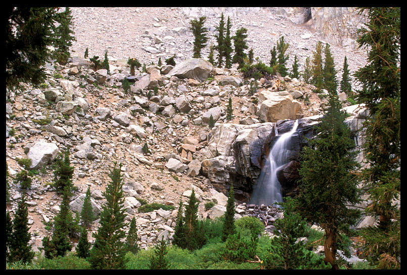
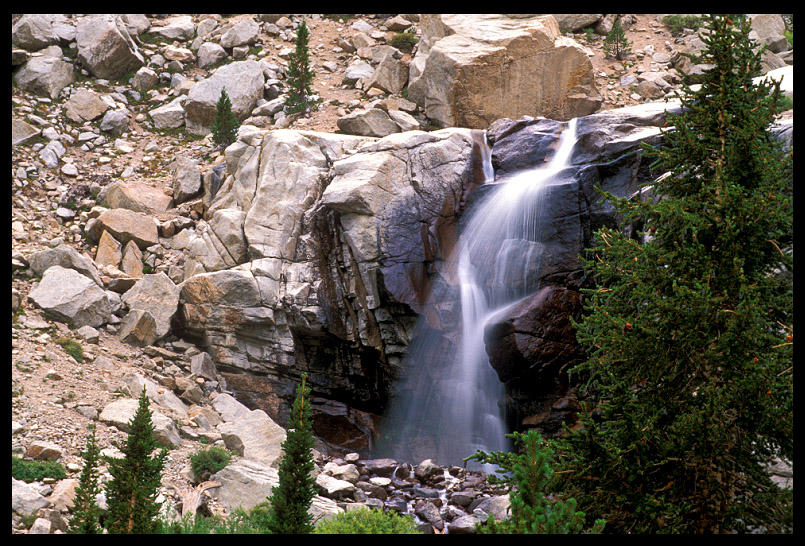
As we dropped down the eastside of Mt. Whitney, just a few steep downhill miles from culminating our journey, we came to Outpost Camp. Outpost Camp is one of the popular places to camp for those climbing Mt. Whitney, and it's in a beautiful setting, surrounded by huge ridges on three sides with a big meadow in the middle. This waterfall cascades off a cliff and the creek continues down through the meadow. It was raining when I took this photo, and thunder resounded through the basin. Jim S. and Surfer Dave were probably a mile down the trail in front of me, as I couldn't pass up scenes like this with my camera. I was so happy descending the steep switchbacks back down to Whitney Portal, where the end of our journey and fatty bacon cheeseburgers and Coke® awaited us. The sense of accomplishment from completing such a thru-hike is pretty awesome, and our emotions ran high... we couldn't wipe the smiles off our faces for the next couple of days! It just felt good. In the next two days after coming off the mountain, we ate a month's worth of pizza and cheeseburgers. And looking up at those glorious High Sierra peaks from outside our hotel room in Lone Pine, we can't wait to get back in there again. We have next year's trip(s) already planned. Life is good®.
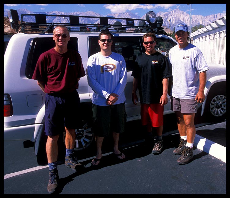
That's Jim on the left, me on the right, and a couple guys we met on the
trail (one of them finished the hike with us, one bailed) at our Lone Pine hotel parking
lot the next morning after the trip. That's Mt. Whitney® in the background. We were on
that summit the day before, woo hoo! Pizza is a wonderful substance. |