Rae Lakes Area
Jim and Dave making their way down Woods Creek
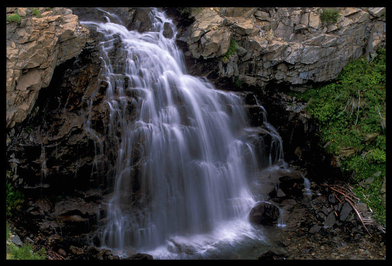
Wood's Creek Falls. Anytime water is silked, it is SO professional you don't EVEN know. Here I am displaying my professionalism. This was a professional waterfall on Woods Creek, down in the canyon, so I had to take it with my 70-200mm zoom. I had to whip out my tripod for this shot, so it made me look like a professional.
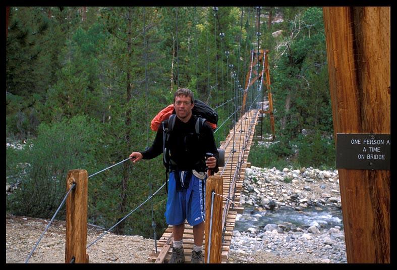
Dave crossing "The Golden Gate of the JMT"
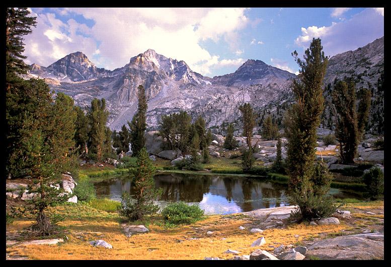
Each basin was so beautiful, but it's tough to beat the beauty of the Rae
Lakes Basin! Okay, a few others tied, but none beat it. With Painted Lady and Fin Dome
dominating the horizon (neither of them in this photo, btw), and lots of gorgeous lakes
and creeks and ponds, along with fantastic fishing, this area is a stunning place to be.
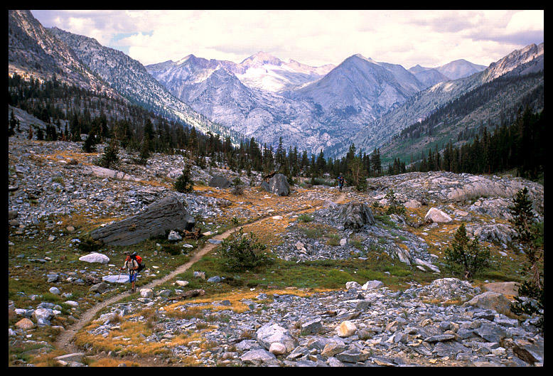
It can get crowded here at times as it's part of a popular 40-mile hike called the Rae
Lakes Loop, but it's tough to get into this basin from any direction. Lots of mileage and
high passes protect this area from weekend backpackers. It's a time-and-energy-investment
destination. This photo is of the creek that connects Arrowhead Lake with Dollar Lake. We
were out of fuel and very low on food at this point. We had become... PIRATES. Well,
friendly pirates. Okay, beggars. We're not too proud to admit it. We were assisting others
in lightening their packs. That sounds better.
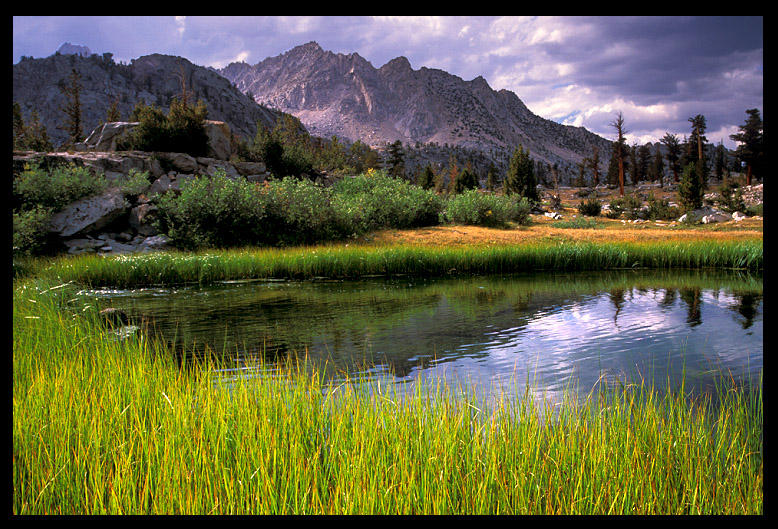
It was a long, steady climb up to the Rae Lakes zone from Woods Creek. We had descended a lot of altitude dropping down from Pinchot Pass and dropped well below treeline, crossed the "Golden Gate Of The JMT", which is a really cool Golden Gate style swinging bridge over Woods Creek (one person at at a time, please, thank you), and then we regained a lot of altitude back up to Dollar Lake. By the time we hit Dollar Lake, I was starving. I had an allotment of three mini-Heath bars a day for lunch/snacks, which wasn't enough. We were out of fuel so on the shore of Dollar Lake I poured cold water into some instant mashed potatoes. It totally completely sucked, but it was caloric. Jim and Dave hiked up on to Rae Lakes to see if they could snag some fuel and food from the backcountry ranger station. I stayed back and took some photos and caught lots of brookies from Dollar Lake. I took my time and slowly made my way back up the trail, stopping to admire the beauty and snap a few shots. This photo is of a pond above Dollar Lake and below Arrowhead Lake, near the creek in the post above this one. The weather was still threatening, but not too bad, so the sun would pop out now and then and light up the land. It was late afternoon when I arrived at this grassy pond. Jim did happen to get some life-saving food from a group of women who were glad to have their packs lightened. And yes, Jim can talk a woman out of anything. It's that W. Virginia charm, and his drawl doesn't hurt him a bit.
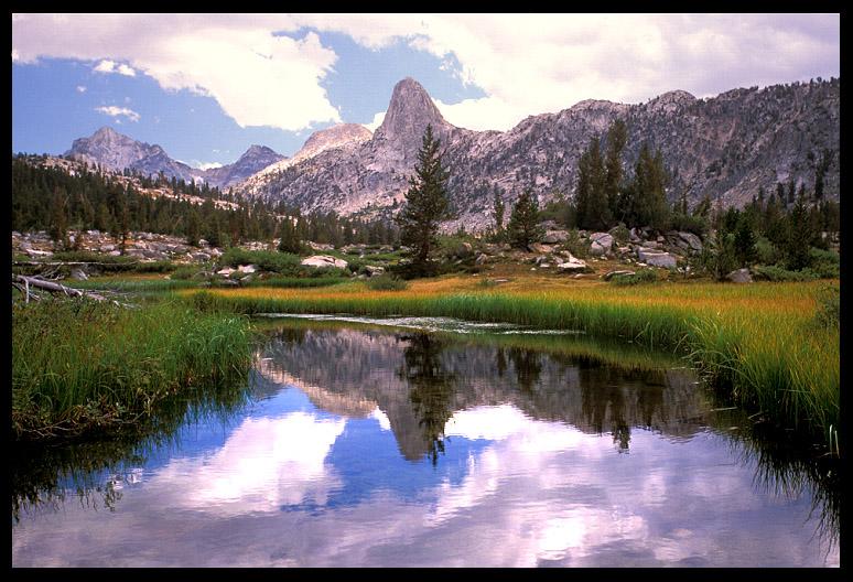
Same area, Rae Lakes Basin. This is between Dollar Lake and Arrowhead Lake, where the grass-fringed creek casually winds through meadows. Seeing a quiet creek like this also means... level ground. YAAAAAA! You don't get too many sections of level hiking on this trail called the JMT�. We enjoy each and every step when we do. Fin Dome is a peculiar looking dome. I'm looking forward to spending a week in this basin (and the nearby 60 Lakes Basin and Gardiner Lakes). Although we spent the night at the highest Rae Lake, it's impossible to really experience an area when you're crankin' right thru it. I didn't even get a chance to fish this area, and it's renowned for its fishing. But I feel blessed to have even had the opportunity to hike thru it, so no complaints here. God has done a wonderful job with this place.
Painted Lady is one of the dominant peaks in the Rae Lakes. True to form, ladies usually dominate. It is a colorful peak though. This shot wasn't taken with my ultra wide angle, which is why the mountain doesn't seem squished like in all my other shots. Glen Pass goes off to the right of the photo, up over one of those high ridges (pant... pant), which we did the following morning.
Here Dave walks towards the Rae Lakes Basin, just below Dollar Lake. This
is what the John Muir Trail is all about. An easy-to-follow quaint trail fringed with
grass, forested canyons with magnificent peaks constantly in the background. This trail
will kick your butt at times, but it will also reward you with some of the best scenery
you've ever laid your eyes upon. And if you hike with the right folks, it will provide you
with a lifetime of wonderful memories with good buddies to boot. Not that you should boot
your good buddies, but you know what I mean. Buck has spoken.
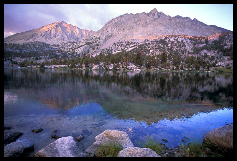
Middle Rae Lake, evening and sunset. The lake never did glass-out that evening despite my hopes that it would. But standing there on the shoreline, I didn't mind, it was actually pretty cool the way the colors danced on the water. This is looking in the direction we had come earlier that afternoon, with Glen Pass in the opposite direction. Jim and Dave were back at our camp at this time, about 50 yards away, closer to the upper Rae Lake. The uppermost Rae Lake was stunning too, and I was torn on which lake to spend the last of the evening on. This is a basin I want to spend a week in, it is sooo beautiful in all directions. It wasn't long after I took this shot that the clouds turned their usual bright red.
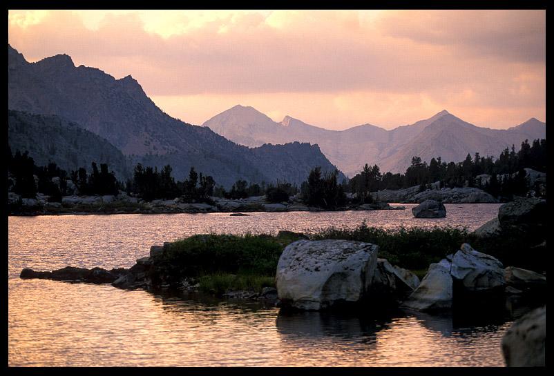
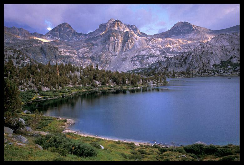
Largest of the Rae Lakes. This was another handheld shot taken literally from the JMT. It was evening by the time I made it here. There is a smaller, very beautiful Rae Lake in the next bowl at the base of those peaks, which is where we camped. The middle peak over this lake is Painted Lady. There were trout rising all over the place. Jim had already secured some great snack food from a group of gregarious women who were more than willing to part with some of their pack weight. If they hadn't given us the food, we were planning on jumping them on the trail, half-way up the next pass when they would be especially exhausted. JUST KIDDING. We wouldn't do that. We were just planning to harmlessly raid the bear storage box that night and steal their food. Surely they would have thought a very dexterous bear had taken their food. We couldn't "jump" them. We're just not that way. But I'm thankful to them for their generosity, and thankful to Jim S., aka "The Negotiater", for his drawl.
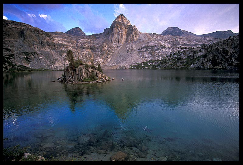
Painted Lady above Upper Rae Lake. This is the lake we camped on. Okay, we didn't camp ON the lake, come on, you know what I mean. It had a really neato little island... actually two of them, one is just out of view to the left. This lake was filled with water and brook trout. If you swam out to that little island in the lake, you'd be there.
|